Bird Watching
Cruising
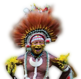
Culture
Diving
Fishing
History
Kayaking
Snorkeling
Surfing
Trekking
This interactive map of Papua New Guinea is a great tool to help you find out just where in the world our mysterious yet beautiful country is located and some of the wonderful places and things you can do here.
It’s easy to get here, as we have one international airport in our capital city, Port Moresby. From our nation’s capital you can visit other parts of the country by air. You will find there are many wonderful places to stay, explore and experience in the land of a million different journeys.
Papua New Guinea is located in the southwestern Pacific Ocean, just north of Australia. It shares its western land border with Indonesia and is part of the island of New Guinea, the second largest island in the world. PNG also shares maritime borders with the Solomon Islands to the east and Australia to the south.
The country sits just below the equator, within the Melanesian region of Oceania. It lies between latitudes 0° and 12° South, and longitudes 140° and 160° East.
Capital City: Port Moresby
Mainland and Islands: PNG includes over 600 islands across 22 provinces.
Total Area: Approx. 462,840 km² (land + sea)
Island Groups: Bismarck Archipelago, Louisiade Archipelago, D’Entrecasteaux Islands
| Direction | Border/Neighbour |
|---|---|
| West | Indonesia (Western New Guinea) |
| South | Coral Sea, Australia |
| East | Solomon Sea, Solomon Islands |
| North | Bismarck Sea, Pacific Ocean |
"*" indicates required fields
Thank you for submitting your business form. We will have our team look over the details and then contact you once we have added your details to our website.